


Is a laser rangefinder with GPS positioning function considered top-level equipment?
Combining military equipment configuration logic and searched professional information, GPS positioning is not the sole criterion for determining whether a military laser rangefinder is top-tier equipment, but rather a core feature of high-end tactical models. Its value must be assessed based on mission scenarios, multi-module interoperability, and overall performance. This can be analyzed from the following three perspectives:
First, GPS functionality is a "standard enhancement" for high-end military rangefinders, not a unique identifier of top-tier status.
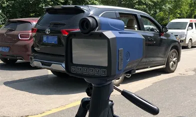
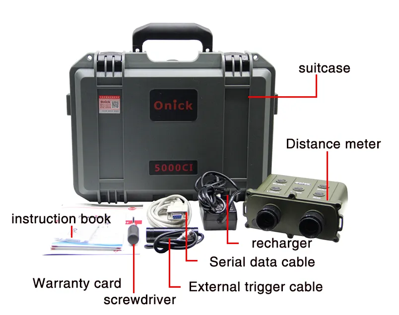
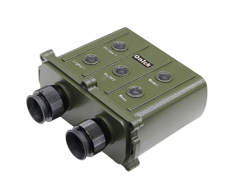
In the military, the core competitiveness of laser rangefinders is primarily determined by fundamental performance indicators: range, accuracy, and environmental adaptability are the cornerstones of classification. For example, models capable of achieving a range of over 8,000 meters, an accuracy within ±0.3 meters, and withstanding extreme temperatures ranging from -40°C to 60°C already possess the characteristics of high-end equipment. The core function of GPS positioning is to achieve synergistic benefits in "ranging + positioning": GPS obtains the rangefinder's own three-dimensional coordinates (latitude, longitude, and altitude). Combined with the target's slant range measured by laser and attitude data provided by a three-dimensional digital compass, the target's precise geographic coordinates can be quickly calculated. This capability is crucial for missions like tactical reconnaissance and firepower calibration. For example, after scouts measure the distance to enemy positions, GPS data can directly synchronize target coordinates to the command center, providing strike parameters for artillery and missiles. In actual equipment, mid- to high-end military rangefinders such as the 12000CI, 15000CI, and 20000CI are commonly equipped with GPS collaboration functionality, linking with GPS devices via an RS232 interface. In the tactical kit purchased by the National University of Defense Technology, the combined navigation module directly integrates BDS/GPS multi-system positioning capabilities, working in conjunction with sensors such as radar and IMUs. This demonstrates that GPS functionality is a common feature of high-end models, but GPS alone, lacking fundamental performance features like ultra-long range and high accuracy, still does not qualify as "top-tier equipment."
Second, Top-tier Military Rangefinders Require Systematic Capabilities of "GPS + Multi-Module Integration"
The core of truly top-tier equipment lies in the tactical value of multi-sensor integration, of which GPS is only one component. In military scenarios, single-system ranging or positioning functions are insufficient to meet complex mission requirements. Top-tier models often integrate the following key modules:
Multi-system positioning module: In addition to GPS, these modules are typically compatible with global navigation systems such as Beidou (BDS) and GLONASS to prevent positioning failures caused by interference with a single signal. For example, the combined navigation module purchased by the National University of Defense Technology supports multi-system joint positioning, with a heading accuracy of up to 0.2°, ensuring stable coordinate output even in strong electromagnetic interference environments.
Environmental perception and compensation module: This module combines a three-dimensional digital compass (for azimuth), an inclinometer (for pitch angle), and meteorological sensors (for wind speed and air pressure) to achieve "distance + attitude + environment" data fusion. For example, after obtaining the target's own altitude through GPS, it combines it with slant range and tilt angle measured by laser to automatically calculate the target's actual horizontal distance and altitude difference, which is crucial for deploying firepower in mountainous areas.
Data link interoperability: GPS-based target data must be integrated into the combat system in real time. Top-tier rangefinders can communicate with drones, tactical terminals, and command centers via wireless links, achieving a closed "measurement-positioning-strike" loop. For example, after a rangefinder measures the coordinates of an armored target, GPS data can directly guide drone reconnaissance or artillery alignment, a systemic value that GPS alone cannot achieve.
Third, scenario requirements determine the "necessity" of GPS functionality; top-tier equipment must be adapted for real-world combat.
The value of GPS functionality varies depending on the mission scenario, and the equipment's level must be determined based on the operational requirements it meets:
In scenarios like border patrols and field reconnaissance, GPS is a "must-have" feature. Soldiers need to quickly locate themselves and the target, creating a battlefield situation map. In these situations, a rangefinder with GPS can significantly improve mission efficiency and is considered core equipment. For example, the GPS collaboration function of the binocular 20000CI rangefinder supports data fusion from 5-8 observation points in the field, accurately calculating the target's three-dimensional coordinates.
In scenarios like urban fighting and close-quarter assaults, range requirements are typically under 20,000 meters, and obstructions from buildings may cause GPS signal loss. In these situations, the core competitiveness of equipment shifts to fast response (e.g., ranging within 0.3 seconds) and anti-interference laser technology (e.g., 20,000-meter eye-safe laser), making GPS less of a critical metric.
The ultimate standard for top-tier equipment is "reliable output in extreme scenarios"—for example, the ability to achieve short-term positioning compensation using an inertial measurement unit (IMU) when GPS signals are suppressed while maintaining laser ranging accuracy; or the use of 20,000-meter laser technology to balance range and concealment (avoiding enemy detection). This "no weaknesses + strong synergy" configuration is the core characteristic of top-tier equipment.
In summary, laser rangefinders with GPS positioning are an essential component of high-end military equipment, but their "top-tier" status requires a comprehensive assessment of range, accuracy, multi-module integration capabilities, and scenario adaptability. For military field surveying, models that achieve "GPS + Beidou dual-mode positioning + ultra-long range + environmental compensation + data link coordination" are truly top-tier equipment, fully supporting tactical decision-making and combat operations.
If you'd like to learn more about specific models (such as the parameters of a GPS-equipped rangefinder used by a certain country's military), or want to explore the technical differences between GPS and Beidou dual-mode positioning in rangefinders, I can provide further analysis.